Community
24 April, 2025
New neighbourhood proposed
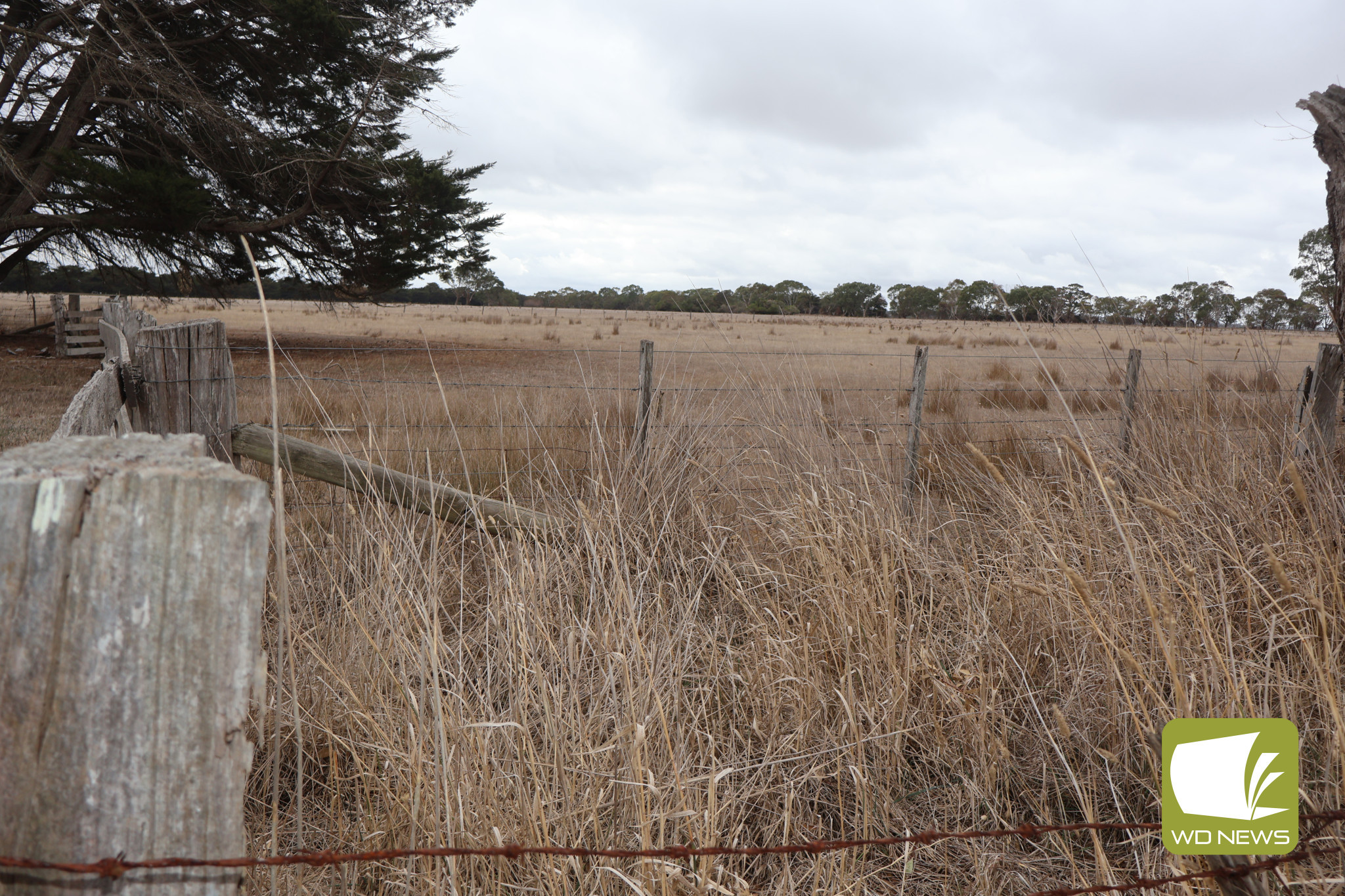
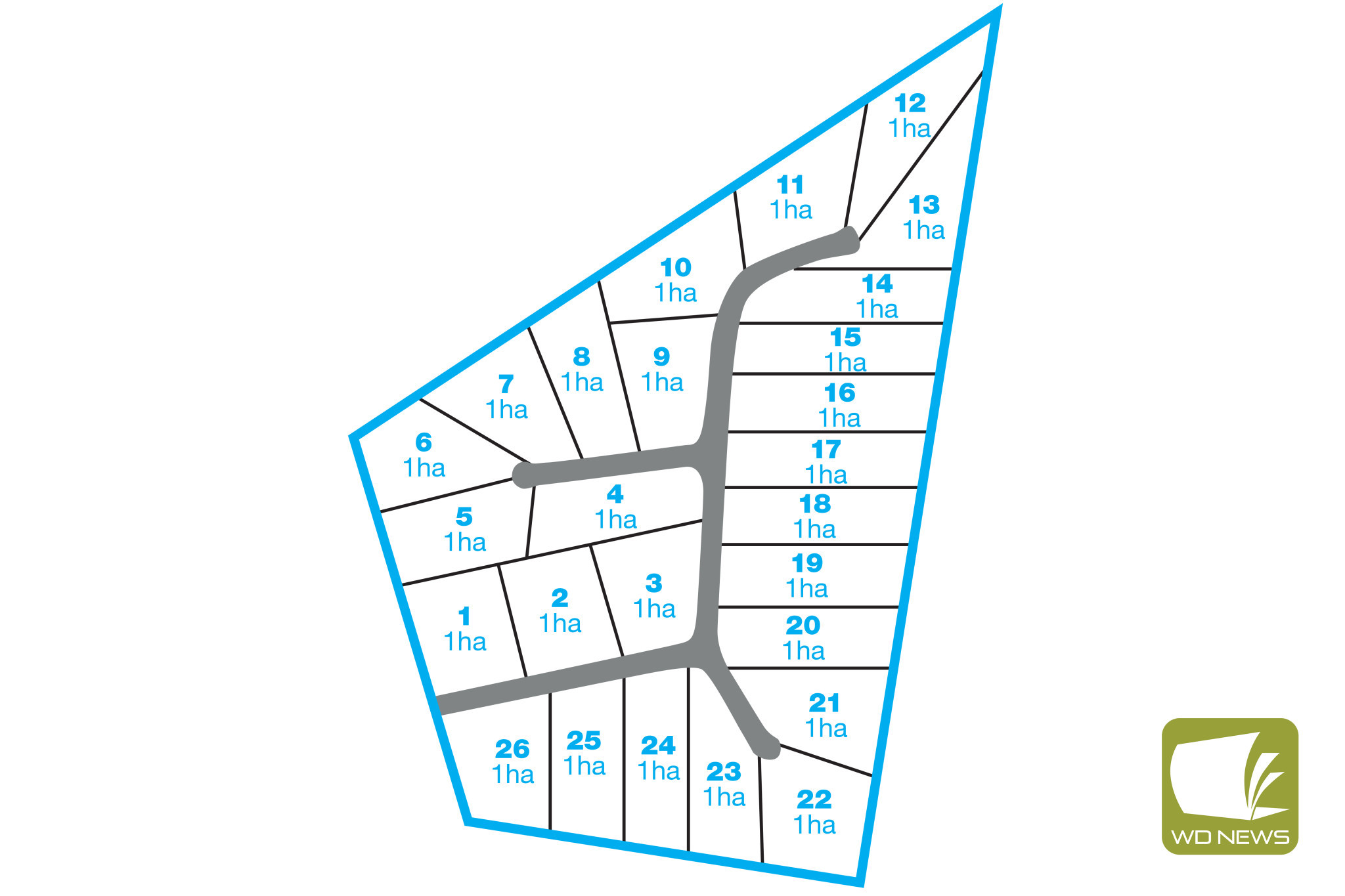
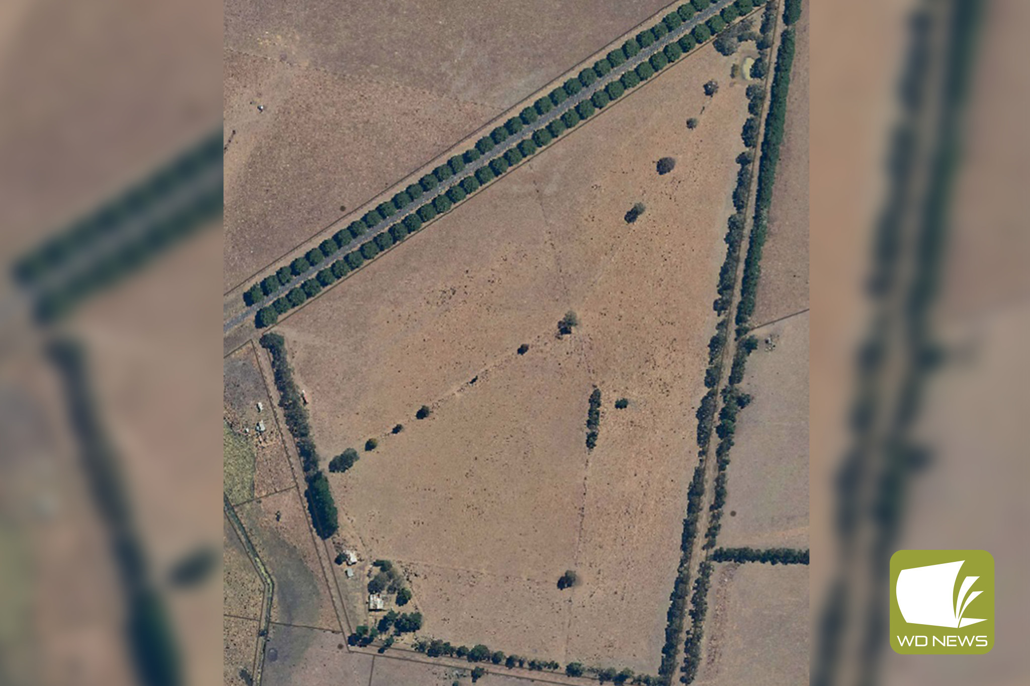
A NEW 26-lot subdivision has been lodged with Moyne Shire Council to bring “a new neighbourhood” to the outskirts of Mortlake.
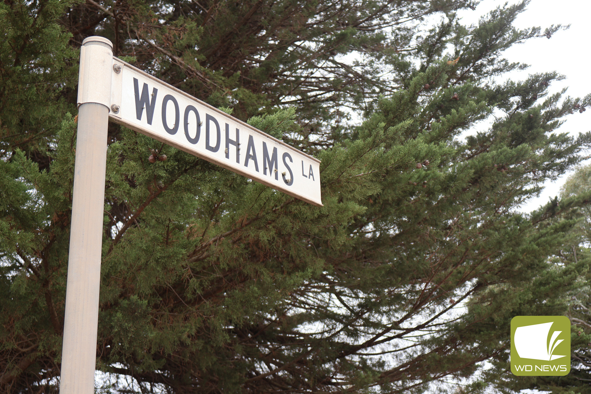
The block encompasses Woodhams Lane and Old Depot Lane through to the Hamilton Highway, which is proposed to be subdivided in to 26 blocks of one hectare.
The planning permit before council notes the site is already within a Rural Living Zone with no overlay which affects the site.
“The subject land is located on the outskirts of Mortlake, providing an opportunity to supply high-quality land to the town,” the application states.
“The proposal aims to create a new neighbourhood consistent with the unique small village character of Mortlake.”
The application notes the development would be in line with relevant council strategy which is designed to encourage the development of Mortlake with respect to the town’s character and promote Mortlake as an agribusiness, retail and service centre for the surrounding region.
“The proposal is located within the settlement boundary and designated for residential development,” the application states.
“While the broader strategy identifies Mortlake as having low to moderate growth capacity, the subject land provides a distinctive opportunity to enhance the town’s residential land supply.
“By contributing significantly to the available housing stock, this proposal supports the goal of limiting out-of-settlement development and promoting concentrated growth within established boundaries.
“It aligns with Mortlake’s strategic vision and development objectives.”
The site is currently used for pasture but could be transformed to bring new life to the Mortlake community.
Key objections of the subdivision include the construction of additional outbuildings alongside dwellings on each lot, the construction of both volume-built dwellings and custom-designed residential developments, minimizing road intersections and preserving as much vegetation as possible along the Woodhams Lane roadside and promoting a sense of community through the inclusion of cul-de-sac and court bowl roads.
The application also proposes the creation and extension of public road network land to provide road access and services to all proposed sites on the 28.157ha area.
“All services, road, and pedestrian networks will be provided for all stages, should the development be constructed as a single project,” the application states.
The subdivision is not planned as a staged development however, if it is determined during the detailed design phase that one or more stages can be constructed concurrently, it is requested the structure of any permission granted accommodates this flexibility.
Moyne Shire Council, as the responsible authority, will not decide on the application prior to Wednesday, May 7.
A submission can be lodged using an objection to grant of planning permit form.
To view the application: visit the Moyne Shire Council office or view the proposed plans online at www.moyne.vic.gov.au/planningnotices.
Read More: Mortlake